Shadowmark Maps › LiDAR sites › Yeavering Bell
Yeavering Bell in LiDAR
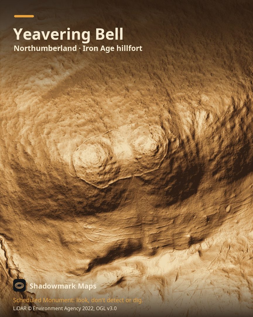
Yeavering Bell is an Iron Age hillfort in Northumberland. Here it is in the Environment Agency's 1 m LiDAR, shaded so the shape of the ground stands out. Look for a broad oval ring of tumbled stone about 900m round the twin summits, crescent banks beyond its east and west ends, and many small hut platforms inside.
What you can see
- The fort's tumbled stone bank, mostly 8m to 9m wide, runs for just over 900m around the hilltop. (keystothepast.info)
- A 1998 survey recorded 125 hut platforms inside, with quarry hollows cut along the inside of the rampart. (keystothepast.info)
- Crescent-shaped banks beyond the east and west ends mark an earlier line of defence, abandoned when the fort was shortened. (keystothepast.info)
- Northumberland's Historic Environment Record says the hillfort is thought to date to the third century BC. (keystothepast.info)
Visiting
The Gefrin Trust route guide describes a signposted footpath to Yeavering Bell beside the Old Palace at Old Yeavering, and a longer route via St Cuthbert's Way that enters the fort by its southern entrance. (gefrin.com)
Official record: Historic England list entry 1006561: Yeavering Bell camp.
Look, don't detect or dig
Yeavering Bell is a Scheduled Monument, protected by law because it's of national importance. In England it's a criminal offence to use a metal detector on a Scheduled Monument without Historic England's written consent, and to remove any object of archaeological or historical interest found with one. Damaging a scheduled monument is an offence too, and works on one, including digging, need Scheduled Monument Consent first. More on Scheduled Monuments and the rules.
Keep to paths and open access land, and follow the Countryside Code.
Get an email when it launches
Shadowmark Maps is coming to the App Store and Google Play. Leave your email and we'll tell you when it's out, with the links to download it.
More sites in LiDAR
Housesteads Roman Fort · Thornborough Henges · Wharram Percy · Mam Tor · all sites