Shadowmark Maps › LiDAR sites › Thornborough Henges
Thornborough Henges in LiDAR
Thornborough Henges is a Neolithic henge complex in North Yorkshire. Here it is in the Environment Agency's 1 m LiDAR, shaded so the shape of the ground stands out. Look for three large rings about 250m across in a line running north-west to south-east; the tree-covered northern henge is relatively well preserved.
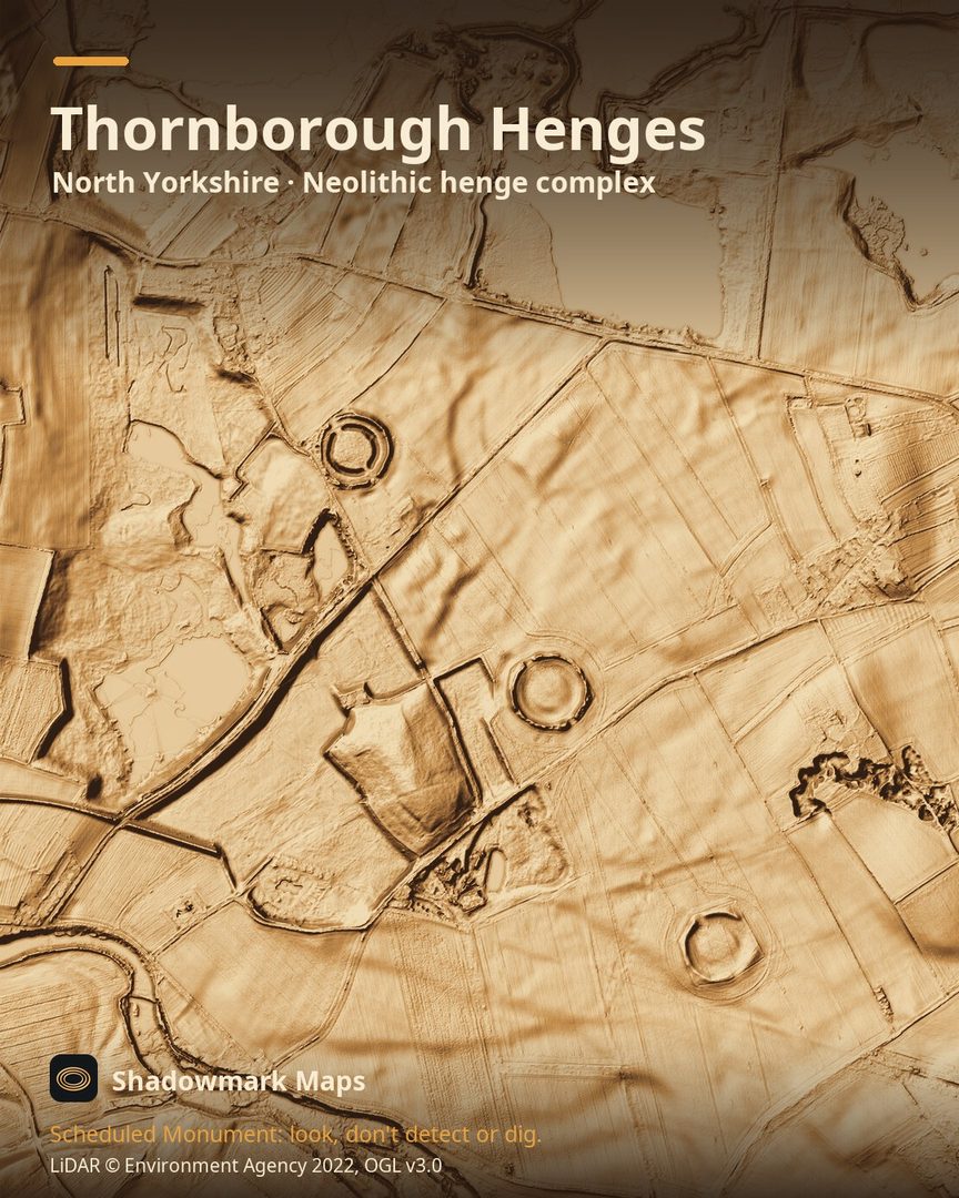
What you can see
- Three henges, each about 250m across, are set out in a north-west to south-east line stretching over a mile. (English Heritage)
- Their banks once stood up to 4m high, each broken by two opposing entrances. (English Heritage)
- In the tree-covered northern henge, the inner ditch is still up to 2.6m deep and 20m wide, and the bank up to 3m high. (English Heritage)
- The southern entrances of the northern and central henges line up with the midwinter solstice sunrise. (English Heritage)
Visiting
English Heritage says the three henges are open, free, any reasonable time during daylight hours, entered through gates and from public footpaths. It asks visitors not to climb the banks, and parts can close for weather or conservation work, so check its page before you go. (English Heritage)
Official record: Historic England list entry 1004912: Earth circles, cursus, pit alignments and burial sites near Nosterfield and Thornborough, including Centre Hill round barrow.
Look, don't detect or dig
Thornborough Henges is a Scheduled Monument, protected by law because it's of national importance. In England it's a criminal offence to use a metal detector on a Scheduled Monument without Historic England's written consent, and to remove any object of archaeological or historical interest found with one. Damaging a scheduled monument is an offence too, and works on one, including digging, need Scheduled Monument Consent first. More on Scheduled Monuments and the rules.
Keep to paths and open access land, and follow the Countryside Code.
Get an email when it launches
Shadowmark Maps is coming to the App Store and Google Play. Leave your email and we'll tell you when it's out, with the links to download it.
More sites in LiDAR
Wharram Percy · Mam Tor · Housesteads Roman Fort · Gainsthorpe · all sites