Shadowmark Maps › LiDAR sites › Gainsthorpe
Gainsthorpe in LiDAR
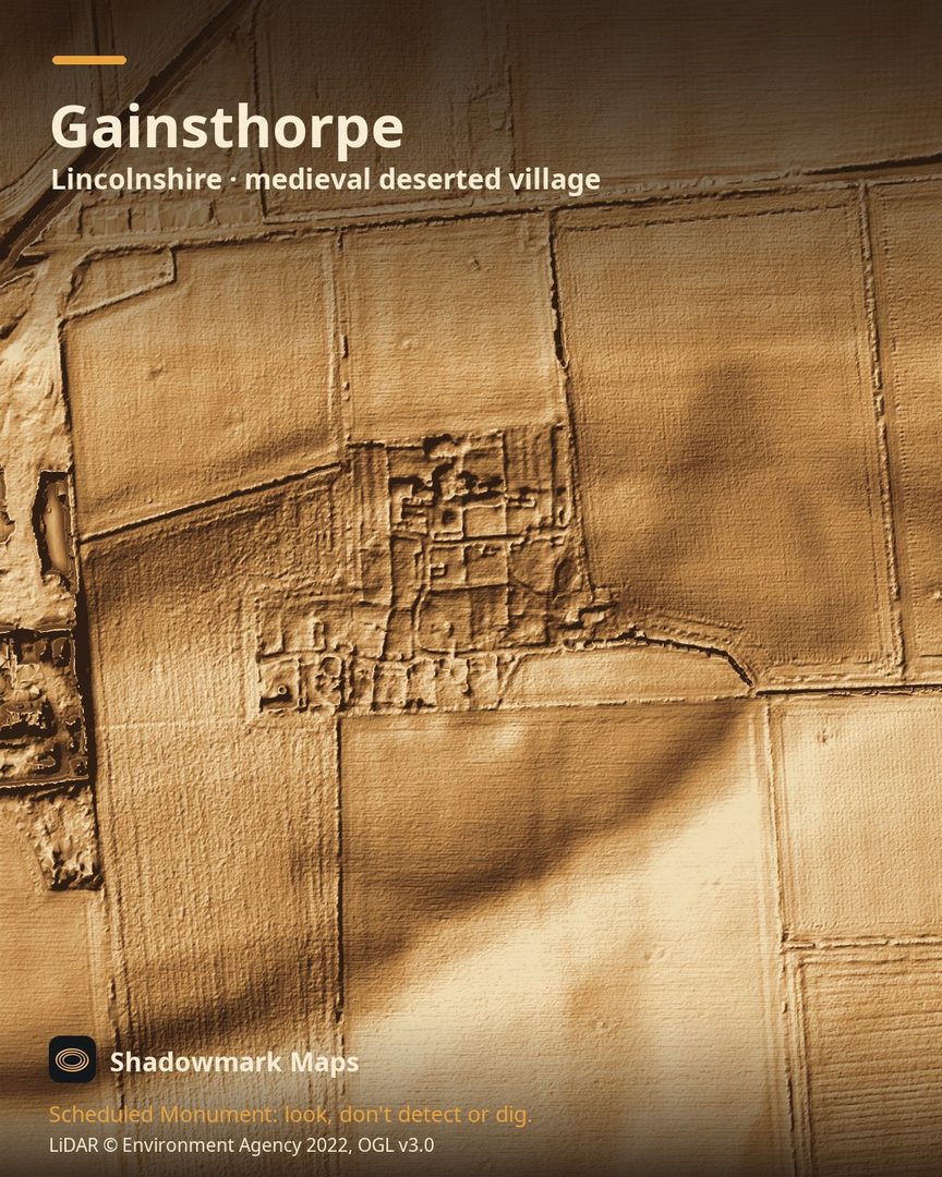
Gainsthorpe is a medieval deserted village in Lincolnshire. Here it is in the Environment Agency's 1 m LiDAR, shaded so the shape of the ground stands out. Look for building footings and walled yards divided by sunken tracks, with two small circular dovecote bases and a small rectangular fishpond at the manor in the south-west corner.
What you can see
- Grassed-over wall footings mark the houses, outbuildings and yards of six to ten properties, one probably a manor. (Historic England)
- The properties are divided by sunken trackways, each a large walled enclosure split into smaller yards. (Historic England)
- Beside the manor courtyards are the bases of two circular buildings about 6m across, thought to be dovecotes, and a fishpond about 13m by 5m. (Historic England)
- In 1925 it became the first deserted medieval village to be photographed from the air, by O G S Crawford. (Historic England)
Visiting
English Heritage says entry is free and it is open any reasonable time during daylight hours, with free parking in a corner of the farmer's field except when the farmer needs it. (English Heritage)
Look, don't detect or dig
Gainsthorpe is a Scheduled Monument, protected by law because it's of national importance. In England it's a criminal offence to use a metal detector on a Scheduled Monument without Historic England's written consent, and to remove any object of archaeological or historical interest found with one. Damaging a scheduled monument is an offence too, and works on one, including digging, need Scheduled Monument Consent first. More on Scheduled Monuments and the rules.
Keep to paths and open access land, and follow the Countryside Code.
Get an email when it launches
Shadowmark Maps is coming to the App Store and Google Play. Leave your email and we'll tell you when it's out, with the links to download it.
More sites in LiDAR
Wharram Percy · Mam Tor · Arbor Low · Burrough Hill · all sites