Shadowmark Maps › Scheduled Monuments
Scheduled Monuments: what they are and where they are
A Scheduled Monument is an archaeological site or historic structure that the law protects because it's of national importance. England's list has about 20,000 entries, from barrows and hillforts to Roman forts, deserted villages and wartime defences. This page explains what scheduling means, how to find monuments on a map, and the rules for detecting and digging.
What is a Scheduled Monument?
Scheduling is the oldest form of heritage protection in Britain: the first list of protected ancient monuments was made in 1882. Today, in England, the Secretary of State decides what's scheduled, on Historic England's advice, under the Ancient Monuments and Archaeological Areas Act 1979. Each monument has an entry on the National Heritage List for England, with a map of the scheduled area and, for most, a description of why it matters.
Many Scheduled Monuments are earthworks in fields or woods, with nothing on the ground to tell you they're there. That's why they show up so often on LiDAR maps, and why it's worth checking before you search anywhere.
How to find Scheduled Monuments on a map
- Historic England's map search on the National Heritage List shows every scheduled area in England, with its official list entry.
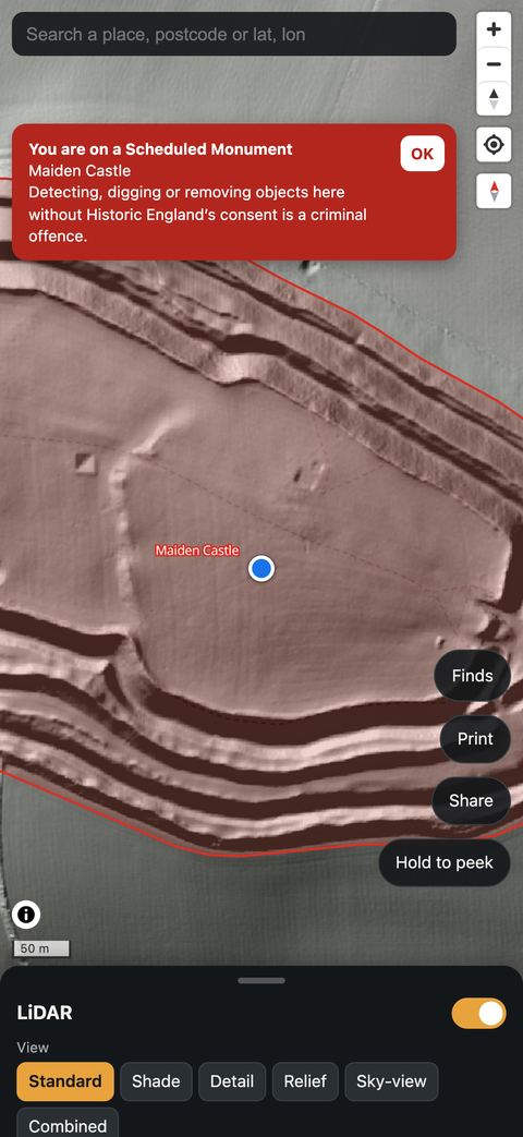
- Shadowmark Maps has the outlines of England's Scheduled Monuments built in, from the National Heritage List. They show in red over the LiDAR, and the app warns you when your GPS position is on or within 50 m of one, even with no signal and with the red layer hidden. The warning is worked out on your phone, so your position isn't sent anywhere.
- Scotland, Wales and Northern Ireland keep their own lists: Historic Environment Scotland, Cadw and the Department for Communities. Shadowmark Maps' red layer covers England only.
The outlines in any app are a guide. The official list entry is the authority, and some monuments' scheduled areas don't match what you can see on the ground.
Metal detecting and Scheduled Monuments
- In England it's a criminal offence to use a metal detector on a Scheduled Monument without Historic England's written consent, and to remove any object of archaeological or historical interest found with one. Damaging a scheduled monument is an offence too.
- Works on a Scheduled Monument, including digging, need Scheduled Monument Consent first.
- There's no fixed buffer zone in the law, but the scheduled areas are drawn on a map and edges aren't marked on the ground. That's why the app warns you from 50 m away.
- Detecting without consent is also an offence in the Areas of Archaeological Importance in the historic centres of Canterbury, Chester, Exeter, Hereford and York.
- Away from scheduled areas, you still need the landowner's permission to detect, and potential Treasure must be reported. The rules section of our LiDAR guide has the details.
Questions people ask
How do I find out if there's a Scheduled Monument near my property?
Search the National Heritage List for England by address or on its map. For sites that aren't scheduled, your county's Historic Environment Record holds much more; many are searchable through the Heritage Gateway.
Can I visit a Scheduled Monument?
Scheduling doesn't give public access. Many monuments are on private land, so use public rights of way or ask the landowner. Others, such as those run by English Heritage or the National Trust, are open to visitors.
Are Scheduled Monuments the same as listed buildings?
No. Both are on the National Heritage List, but listing protects buildings, mostly ones still in use, while scheduling protects archaeological sites and monuments, such as earthworks, ruins and buried remains.
Get an email when it launches
Shadowmark Maps is coming to the App Store and Google Play. Leave your email and we'll tell you when it's out, with the links to download it.