Shadowmark Maps › LiDAR sites › Wharram Percy
Wharram Percy in LiDAR
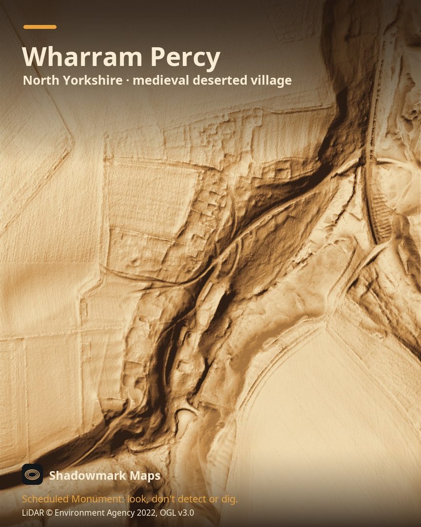
Wharram Percy is a medieval deserted village in North Yorkshire. Here it is in the Environment Agency's 1 m LiDAR, shaded so the shape of the ground stands out. Look for two facing rows of house platforms with banked rectangular plots behind them, and a prominent hollow way running in from the north.
What you can see
- In the late 14th century the village had thirty houses set out in two facing rows, a layout typical of the Yorkshire Wolds. (Historic England)
- The house rows survive as grassed-over stone foundations, with banked rectangular plots behind them. (Historic England)
- A prominent hollow way enters from the north and formed the main road through the village. (Historic England)
- The last record of the village dates from 1517, when the landlord faced legal action for evicting what may have been the last four families. (Historic England)
Visiting
English Heritage says entry is free and the site is open any reasonable time during daylight hours, about three-quarters of a mile on foot from the car park. (English Heritage)
Official record: Historic England list entry 1011377: Wharram Percy deserted medieval village.
Look, don't detect or dig
Wharram Percy is a Scheduled Monument, protected by law because it's of national importance. In England it's a criminal offence to use a metal detector on a Scheduled Monument without Historic England's written consent, and to remove any object of archaeological or historical interest found with one. Damaging a scheduled monument is an offence too, and works on one, including digging, need Scheduled Monument Consent first. More on Scheduled Monuments and the rules.
Keep to paths and open access land, and follow the Countryside Code.
Get an email when it launches
Shadowmark Maps is coming to the App Store and Google Play. Leave your email and we'll tell you when it's out, with the links to download it.
More sites in LiDAR
Thornborough Henges · Gainsthorpe · Mam Tor · Arbor Low · all sites