Shadowmark Maps › LiDAR sites › Mam Tor
Mam Tor in LiDAR
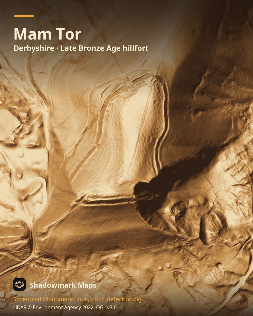
Mam Tor is a Late Bronze Age hillfort in Derbyshire. Here it is in the Environment Agency's 1 m LiDAR, shaded so the shape of the ground stands out. Look for a single rampart and ditch wrapping the edge of a tongue-shaped summit of about 6ha, with small terraced hut platforms on both flanks of the ridge.
What you can see
- A single line of rampart, ditch and counterscarp bank encloses a tongue-shaped summit area of about 6ha. (Historic England)
- Hut platforms are cut into the west and east-facing slopes on either side of the central ridge. (Historic England)
- The rampart follows the 480m contour, while the interior rises a further 38m to the central ridge. (Historic England)
- Pottery and radiocarbon dates from the huts point to a single phase of occupation in the early first millennium BC. (Historic England)
Visiting
The National Trust has been repairing erosion on the hillfort caused by high visitor numbers and encourages visitors to keep to the footpaths rather than climb the earthworks. (National Trust)
Official record: Historic England list entry 1011206: Slight univallate hillfort and two bowl barrows on Mam Tor.
Look, don't detect or dig
Mam Tor is a Scheduled Monument, protected by law because it's of national importance. In England it's a criminal offence to use a metal detector on a Scheduled Monument without Historic England's written consent, and to remove any object of archaeological or historical interest found with one. Damaging a scheduled monument is an offence too, and works on one, including digging, need Scheduled Monument Consent first. More on Scheduled Monuments and the rules.
Keep to paths and open access land, and follow the Countryside Code.
Get an email when it launches
Shadowmark Maps is coming to the App Store and Google Play. Leave your email and we'll tell you when it's out, with the links to download it.
More sites in LiDAR
Arbor Low · Gainsthorpe · Burrough Hill · Thornborough Henges · all sites