Shadowmark Maps › LiDAR sites › Housesteads Roman Fort
Housesteads Roman Fort in LiDAR
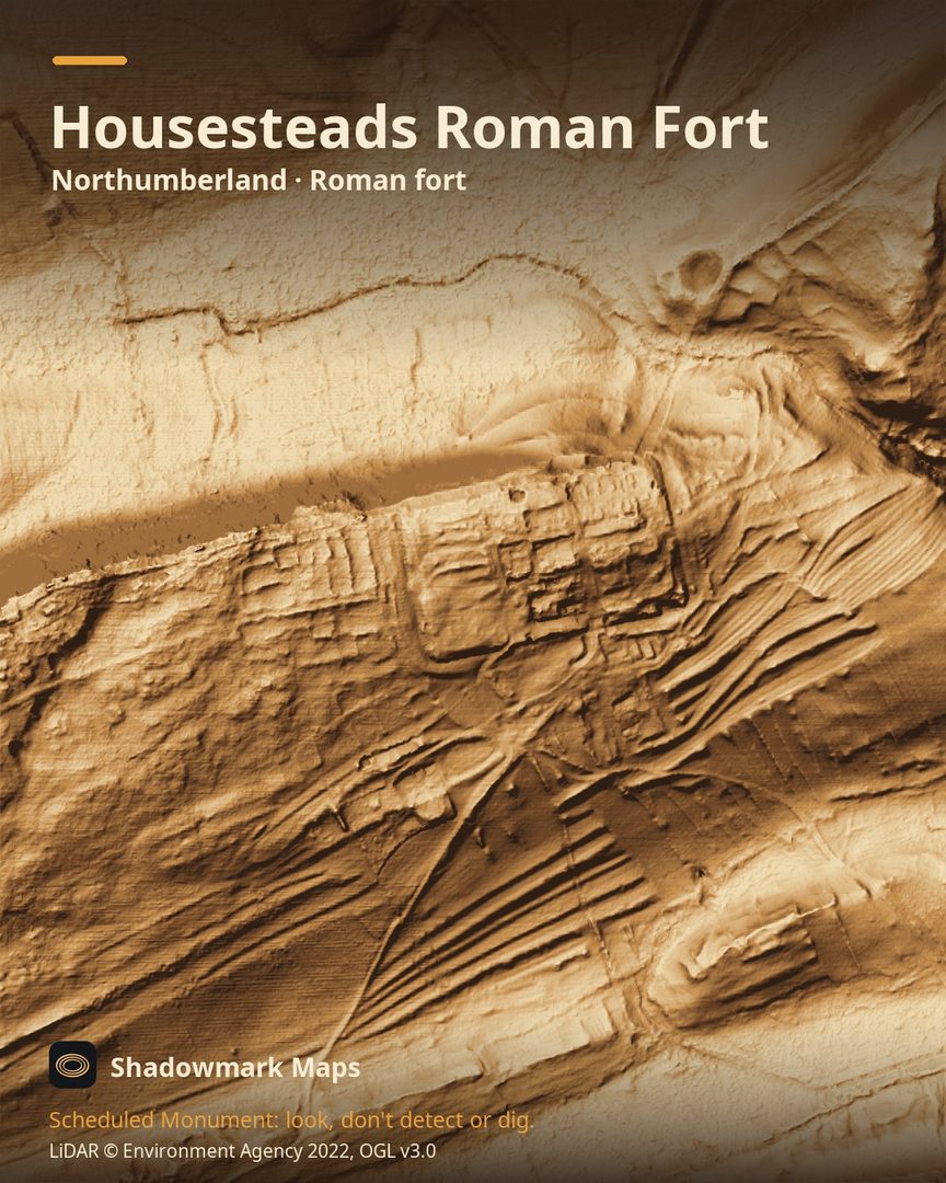
Housesteads Roman Fort is a Roman fort in Northumberland. Here it is in the Environment Agency's 1 m LiDAR, shaded so the shape of the ground stands out. Look for the outline of the fort lying east to west, the Wall and the vallum with the low bank of the Military Way between them, and terraces along the contours to the south and west.
What you can see
- Housesteads fort covers about 2 hectares and held a cohort of 800 to 1,000 men, later reinforced by a cavalry unit. (Historic England)
- Unusually for a Wall fort, Housesteads lies east to west rather than north to south, because of the shape of the ground. (Historic England)
- The Military Way, the Roman road between the Wall and the vallum, survives as a turf-covered bank through most of this stretch. (Historic England)
- South and west of the civil settlement, cultivation terraces run along the contours; they are thought to be Roman. (Historic England)
Visiting
Paid entry (free to English Heritage and National Trust members); hours change with the season, so check English Heritage's opening times before you go. The fort is an uphill walk from the car park. (English Heritage)
Look, don't detect or dig
Housesteads Roman Fort is a Scheduled Monument, protected by law because it's of national importance. In England it's a criminal offence to use a metal detector on a Scheduled Monument without Historic England's written consent, and to remove any object of archaeological or historical interest found with one. Damaging a scheduled monument is an offence too, and works on one, including digging, need Scheduled Monument Consent first. More on Scheduled Monuments and the rules.
Keep to paths and open access land, and follow the Countryside Code.
Get an email when it launches
Shadowmark Maps is coming to the App Store and Google Play. Leave your email and we'll tell you when it's out, with the links to download it.
More sites in LiDAR
Yeavering Bell · Thornborough Henges · Wharram Percy · Mam Tor · all sites