Shadowmark Maps › LiDAR sites › Wayland's Smithy
Wayland's Smithy in LiDAR
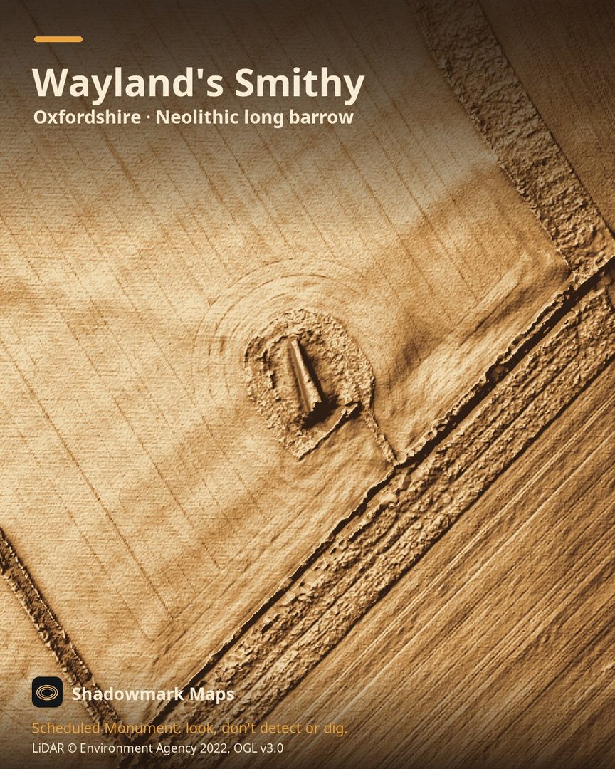
Wayland's Smithy is a Neolithic long barrow in Oxfordshire. Here it is in the Environment Agency's 1 m LiDAR, shaded so the shape of the ground stands out. Look for a long, narrow mound about 56m long lying just north of the line of the Ridgeway.
What you can see
- The visible barrow is a partly reconstructed stone-faced chalk mound 56.4m long and up to 13.1m wide. (Historic England)
- Its south-facing front has four large sarsen stones standing up to 3m high. (Historic England)
- English Heritage says 14 people were buried in an earlier structure between 3590 and 3550 BC, and a far larger barrow was built on top between 3460 and 3400 BC. (English Heritage)
- It lies 50m north of the Ridgeway, about 1km west of Whitehorse Hill. (Historic England)
Visiting
English Heritage says it is free and open any reasonable time during daylight hours, just over a mile's walk from the White Horse Hill car park. (English Heritage)
Official record: Historic England list entry 1008409: Wayland's Smithy chambered long barrow, including an earlier barrow and Iron Age and Roman boundary ditches.
Look, don't detect or dig
Wayland's Smithy is a Scheduled Monument, protected by law because it's of national importance. In England it's a criminal offence to use a metal detector on a Scheduled Monument without Historic England's written consent, and to remove any object of archaeological or historical interest found with one. Damaging a scheduled monument is an offence too, and works on one, including digging, need Scheduled Monument Consent first. More on Scheduled Monuments and the rules.
Keep to paths and open access land, and follow the Countryside Code.
Get an email when it launches
Shadowmark Maps is coming to the App Store and Google Play. Leave your email and we'll tell you when it's out, with the links to download it.
More sites in LiDAR
Uffington Castle and White Horse · Barbury Castle · Fyfield Down · Avebury · all sites