Shadowmark Maps › LiDAR sites › Avebury
Avebury in LiDAR
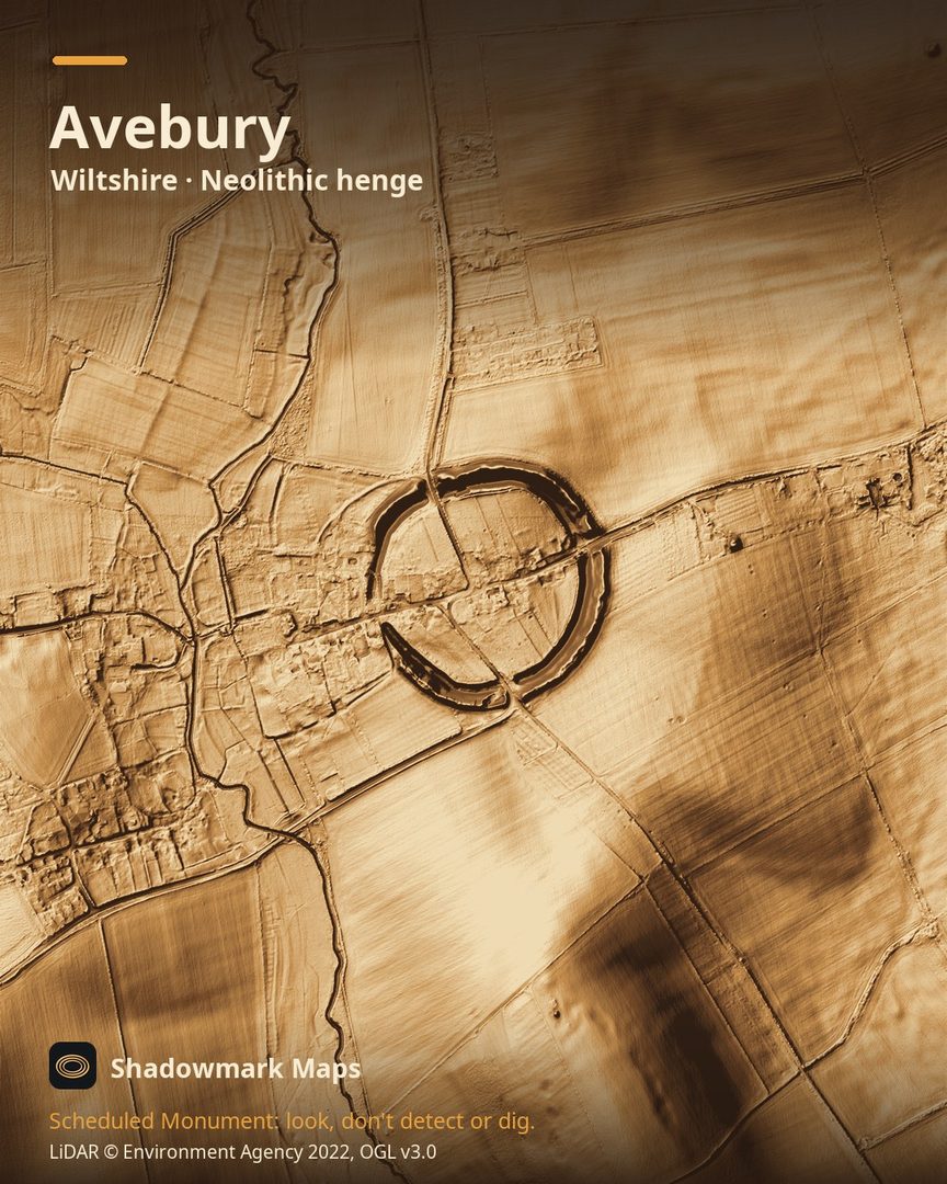
Avebury is a Neolithic henge in Wiltshire. Here it is in the Environment Agency's 1 m LiDAR, shaded so the shape of the ground stands out. Look for the huge ring of bank and inner ditch enclosing part of the village, broken by four entrance gaps roughly at north, south, east and west.
What you can see
- The Avebury henge is a roughly circular ditch with its bank on the outside, enclosing about 11.5 hectares. (Historic England)
- The outer bank, built from the chalk dug out of the ditch, is 22 to 30 metres wide at its base and stands up to 5 metres high. (Historic England)
- Four causewayed entrances led into the henge, all lined up roughly with the points of the compass. (Historic England)
- The stone circle running round the inside of the henge is the largest in Britain, and two smaller stone circles stand within it. (Historic England)
Visiting
Free entry, open any reasonable time during daylight hours; the car park is charged and run by the National Trust (free to English Heritage members with a car sticker). (english-heritage.org.uk)
Official record: Historic England list entry 1015546: Avebury henge and stone circles.
Look, don't detect or dig
Avebury is a Scheduled Monument, protected by law because it's of national importance. In England it's a criminal offence to use a metal detector on a Scheduled Monument without Historic England's written consent, and to remove any object of archaeological or historical interest found with one. Damaging a scheduled monument is an offence too, and works on one, including digging, need Scheduled Monument Consent first. More on Scheduled Monuments and the rules.
Keep to paths and open access land, and follow the Countryside Code.
Get an email when it launches
Shadowmark Maps is coming to the App Store and Google Play. Leave your email and we'll tell you when it's out, with the links to download it.
More sites in LiDAR
West Kennet Long Barrow · Fyfield Down · Barbury Castle · Wayland's Smithy · all sites