Shadowmark Maps › LiDAR sites › Wandlebury Ring
Wandlebury Ring in LiDAR
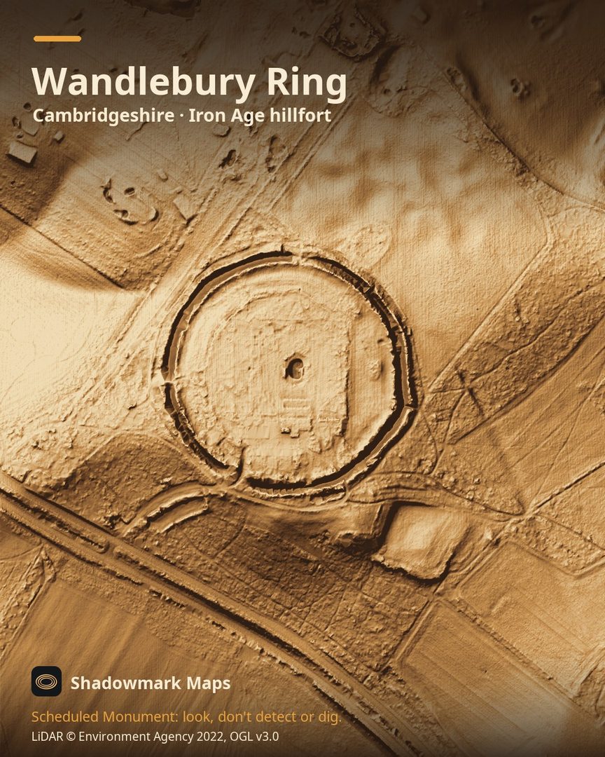
Wandlebury Ring is an Iron Age hillfort in Cambridgeshire. Here it is in the Environment Agency's 1 m LiDAR, shaded so the shape of the ground stands out. Look for a circular ring almost 320m across, with a broad outer ditch around a landscaped interior.
What you can see
- The visible defences are circular and almost 320m across. (Historic England)
- The outer ditch is 10m to 15m wide and up to 3m deep. (Historic England)
- In the 17th century the interior was landscaped into gardens and orchards; the inner ditch was filled in and the banks lowered. (Historic England)
- It sits on the crest of the Gog Magog Hills, about 600m south-west of the Via Devana Roman road. (Historic England)
Visiting
Cambridge Past, Present & Future says the country park is open every day from dawn to dusk with free entry; parking is charged. (Cambridge Past)
Look, don't detect or dig
Wandlebury Ring is a Scheduled Monument, protected by law because it's of national importance. In England it's a criminal offence to use a metal detector on a Scheduled Monument without Historic England's written consent, and to remove any object of archaeological or historical interest found with one. Damaging a scheduled monument is an offence too, and works on one, including digging, need Scheduled Monument Consent first. More on Scheduled Monuments and the rules.
Keep to paths and open access land, and follow the Countryside Code.
Get an email when it launches
Shadowmark Maps is coming to the App Store and Google Play. Leave your email and we'll tell you when it's out, with the links to download it.
More sites in LiDAR
Grime's Graves · Ivinghoe Beacon · Sutton Hoo · Burrough Hill · all sites