Shadowmark Maps › LiDAR sites › Sutton Hoo
Sutton Hoo in LiDAR
Sutton Hoo is an Anglo-Saxon burial ground in Suffolk. Here it is in the Environment Agency's 1 m LiDAR, shaded so the shape of the ground stands out. Look for a cluster of low, worn-down burial mounds, with one, Mound Two, rebuilt to its original height in 1992.
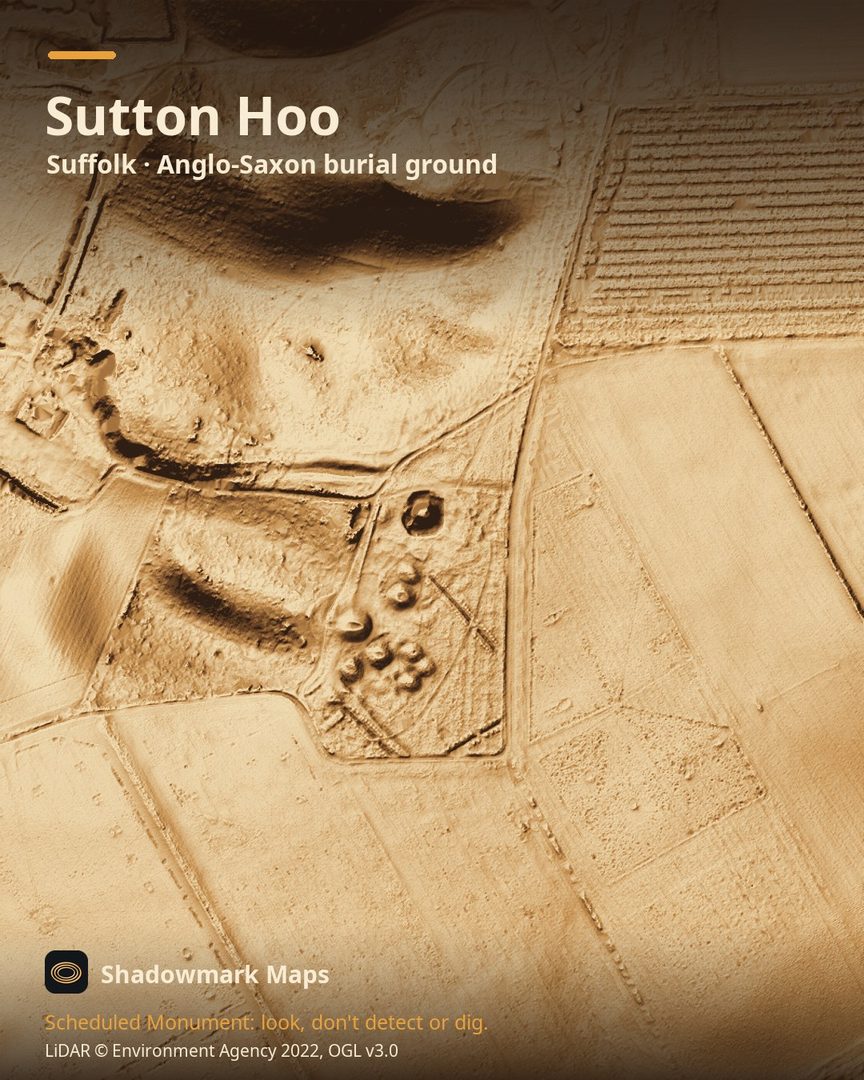
What you can see
- The Royal Burial Ground has around 18 burial mounds; many are so worn down that the exact number is hard to know. (National Trust)
- The burials date to the 7th century AD. (National Trust)
- Mound Two was rebuilt to its original height in 1992, as an experiment to see how long a mound takes to erode. (National Trust)
Visiting
Paid entry (free to National Trust members) with no need to pre-book; opening times vary by day and season, so check the National Trust's Sutton Hoo page before you go. (National Trust)
Official record: Historic England list entry 1006068: Prehistoric settlement and group of barrows (including site of ship burial) at Sutton Hoo.
Look, don't detect or dig
Sutton Hoo is a Scheduled Monument, protected by law because it's of national importance. In England it's a criminal offence to use a metal detector on a Scheduled Monument without Historic England's written consent, and to remove any object of archaeological or historical interest found with one. Damaging a scheduled monument is an offence too, and works on one, including digging, need Scheduled Monument Consent first. More on Scheduled Monuments and the rules.
Keep to paths and open access land, and follow the Countryside Code.
Get an email when it launches
Shadowmark Maps is coming to the App Store and Google Play. Leave your email and we'll tell you when it's out, with the links to download it.
More sites in LiDAR
Grime's Graves · Wandlebury Ring · Ivinghoe Beacon · Burrough Hill · all sites