Shadowmark Maps › LiDAR sites › Grime's Graves
Grime's Graves in LiDAR
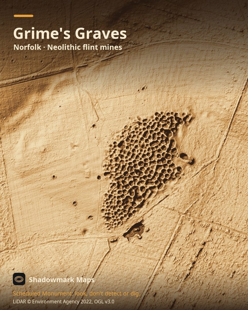
Grime's Graves is a Neolithic flint mines in Norfolk. Here it is in the Environment Agency's 1 m LiDAR, shaded so the shape of the ground stands out. Look for a dense field of hollows and humps, the visible remains of 433 mines and pits.
What you can see
- The earthworks visible at Grime's Graves today are 433 mines and pits, and surveys suggest the mines once covered a much larger area. (English Heritage)
- Miners dug shafts up to 13 metres deep to reach the best flint. (English Heritage)
- Flint mining here began around 2600 BC, in the late Neolithic. (English Heritage)
- The name is Anglo-Saxon: the Anglo-Saxons believed the landscape was the work of the god Grim, or Woden. (English Heritage)
Visiting
Paid entry (free to English Heritage members); hours change with the season, so check English Heritage's opening times before you go. Children under 7 are not allowed into the mine shaft. (English Heritage)
Official record: Historic England list entry 1003619: Grimes Graves, including round barrow in Grimes Graves Plantation.
Look, don't detect or dig
Grime's Graves is a Scheduled Monument, protected by law because it's of national importance. In England it's a criminal offence to use a metal detector on a Scheduled Monument without Historic England's written consent, and to remove any object of archaeological or historical interest found with one. Damaging a scheduled monument is an offence too, and works on one, including digging, need Scheduled Monument Consent first. More on Scheduled Monuments and the rules.
Keep to paths and open access land, and follow the Countryside Code.
Get an email when it launches
Shadowmark Maps is coming to the App Store and Google Play. Leave your email and we'll tell you when it's out, with the links to download it.
More sites in LiDAR
Wandlebury Ring · Sutton Hoo · Burrough Hill · Ivinghoe Beacon · all sites