Shadowmark Maps › LiDAR sites › Uley Bury
Uley Bury in LiDAR
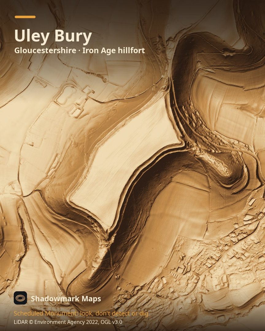
Uley Bury is an Iron Age hillfort in Gloucestershire. Here it is in the Environment Agency's 1 m LiDAR, shaded so the shape of the ground stands out. Look for a large rectangular hilltop of about 23ha outlined by double terraces and steep scarps, with its main gap on the north side.
What you can see
- The hillfort fills the entire summit of a steep-sided Cotswold plateau. (Historic England)
- It is a roughly rectangular enclosure of about 23ha, defined by double terraces and steep scarps, with entrances to the north, east and south. (Historic England)
- Historic England describes it as one of the largest hillforts in the Cotswold region. (Historic England)
Visiting
The Cotswolds National Landscape circular walk follows the path all the way around the hillfort's ramparts. (cotswolds-nl.org.uk)
Official record: Historic England list entry 1004866: Uley Bury camp.
Look, don't detect or dig
Uley Bury is a Scheduled Monument, protected by law because it's of national importance. In England it's a criminal offence to use a metal detector on a Scheduled Monument without Historic England's written consent, and to remove any object of archaeological or historical interest found with one. Damaging a scheduled monument is an offence too, and works on one, including digging, need Scheduled Monument Consent first. More on Scheduled Monuments and the rules.
Keep to paths and open access land, and follow the Countryside Code.
Get an email when it launches
Shadowmark Maps is coming to the App Store and Google Play. Leave your email and we'll tell you when it's out, with the links to download it.
More sites in LiDAR
Belas Knap Long Barrow · British Camp · Barbury Castle · Avebury · all sites