Shadowmark Maps › LiDAR sites › Stonehenge
Stonehenge in LiDAR
Stonehenge is a Neolithic and Bronze Age stone circle in Wiltshire. Here it is in the Environment Agency's 1 m LiDAR, shaded so the shape of the ground stands out. Look for the low circular bank and ditch around the stones with its entrance gaps, and the faint parallel banks of the Avenue leading away from it.
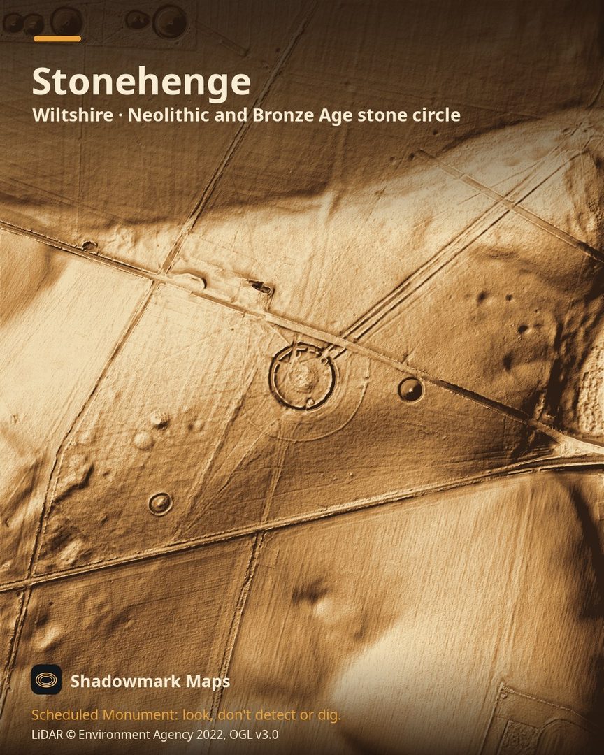
What you can see
- English Heritage says the earliest known major work at Stonehenge was a circular ditch with inner and outer banks, built about 3000 BC, enclosing an area about 100 metres across. (English Heritage)
- The Avenue, a pair of parallel banks with ditches outside them, links Stonehenge with the River Avon at West Amesbury. (Historic England)
- The Avenue shows as a slight earthwork for its first kilometre, to the centre of Stonehenge Bottom, and is hard to see on the ground beyond that. (Historic England)
- Stonehenge was built to line up with the sun at the solstices: on the summer solstice the sun rises behind the Heel Stone in the north-east. (English Heritage)
Visiting
Paid entry with pre-booking encouraged; English Heritage lists it as open Monday to Sunday, 9.30am to 5pm, last entry 3pm. (English Heritage)
Official record: Historic England list entry 1010140: Stonehenge, the Avenue, and three barrows adjacent to the Avenue forming part of a round barrow cemetery on Countess Farm.
Look, don't detect or dig
Stonehenge is a Scheduled Monument, protected by law because it's of national importance. In England it's a criminal offence to use a metal detector on a Scheduled Monument without Historic England's written consent, and to remove any object of archaeological or historical interest found with one. Damaging a scheduled monument is an offence too, and works on one, including digging, need Scheduled Monument Consent first. More on Scheduled Monuments and the rules.
Keep to paths and open access land, and follow the Countryside Code.
Get an email when it launches
Shadowmark Maps is coming to the App Store and Google Play. Leave your email and we'll tell you when it's out, with the links to download it.
More sites in LiDAR
Old Sarum · Danebury · West Kennet Long Barrow · Oakley Down · all sites