Shadowmark Maps › LiDAR sites › Oakley Down
Oakley Down in LiDAR
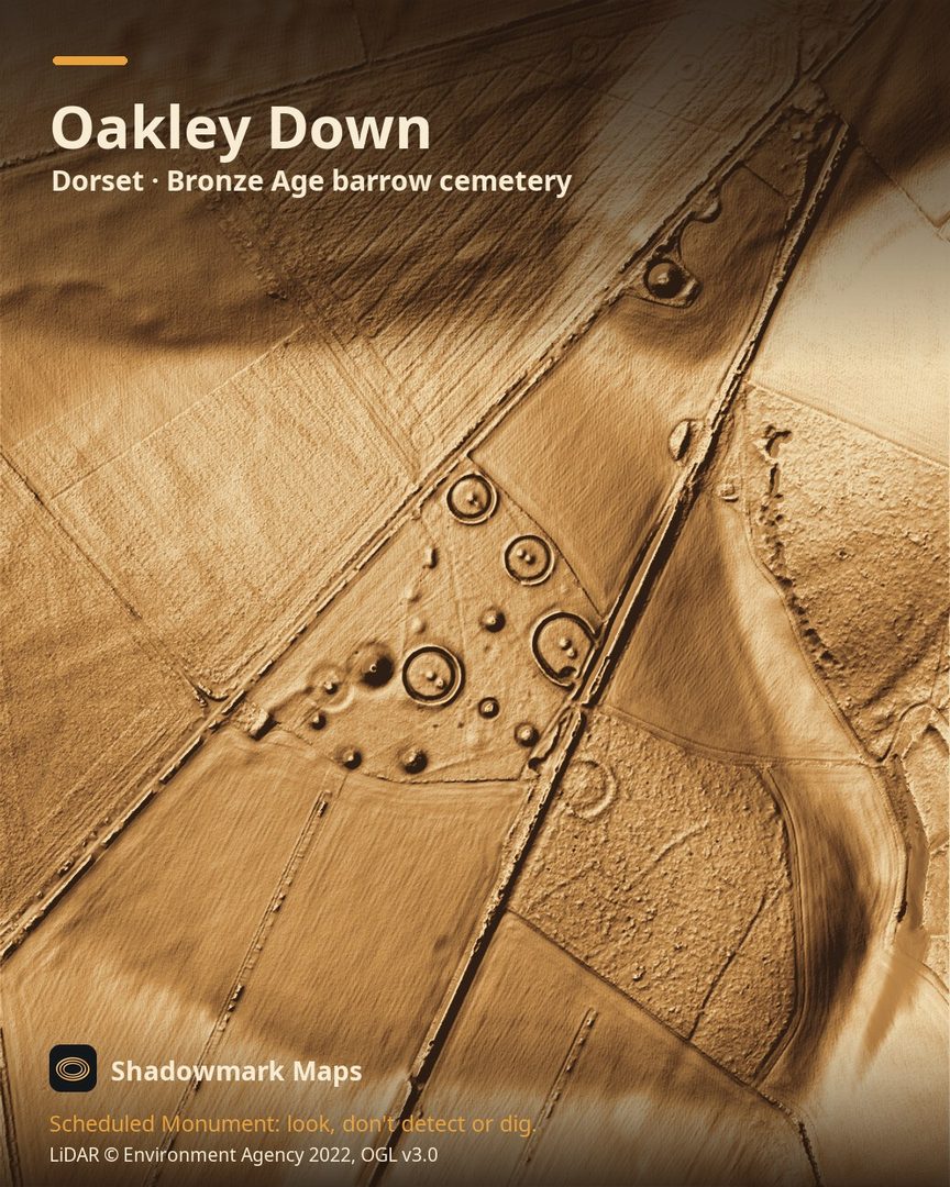
Oakley Down is a Bronze Age barrow cemetery in Dorset. Here it is in the Environment Agency's 1 m LiDAR, shaded so the shape of the ground stands out. Look for a cluster of round mounds and ringed disc-barrow platforms beside the raised bank of Ackling Dyke, with one disc barrow clipped by the Roman road.
What you can see
- The Oakley Down cemetery holds at least six disc barrows, a saucer barrow, three oval mounds and 16 bowl barrows. (Historic England)
- Most of the barrows lie between the modern A354 and the Ackling Dyke Roman road, on two east-facing spurs. (Historic England)
- Its disc barrows are circular platforms 12m to 29m across, ringed by a ditch and outer bank, and one of them is slightly cut by a Roman road. (Historic England)
- The scheduled stretch of Ackling Dyke crossing Oakley Down is about 7.45km long and survives as an earthwork to varying degrees; its bank is 1.2m to 2.5m high and up to 13m wide. (Historic England)
Visiting
Cranborne Chase National Landscape encourages people to walk sections of Ackling Dyke. We found no official access information for the barrows, so view them from public rights of way: check Dorset Explorer first. (cranbornechase.org.uk)
Official record: Historic England list entry 1002674: Group of round barrows on Oakley Down.
Look, don't detect or dig
Oakley Down is a Scheduled Monument, protected by law because it's of national importance. In England it's a criminal offence to use a metal detector on a Scheduled Monument without Historic England's written consent, and to remove any object of archaeological or historical interest found with one. Damaging a scheduled monument is an offence too, and works on one, including digging, need Scheduled Monument Consent first. More on Scheduled Monuments and the rules.
Keep to paths and open access land, and follow the Countryside Code.
Get an email when it launches
Shadowmark Maps is coming to the App Store and Google Play. Leave your email and we'll tell you when it's out, with the links to download it.
More sites in LiDAR
Knowlton · Badbury Rings · Hod Hill · Hambledon Hill · all sites