Shadowmark Maps › LiDAR sites › Danebury
Danebury in LiDAR
Danebury is an Iron Age hillfort in Hampshire. Here it is in the Environment Agency's 1 m LiDAR, shaded so the shape of the ground stands out. Look for the ring of ramparts with the entrance earthworks, the rise to the centre of the interior, and faint dips across it.
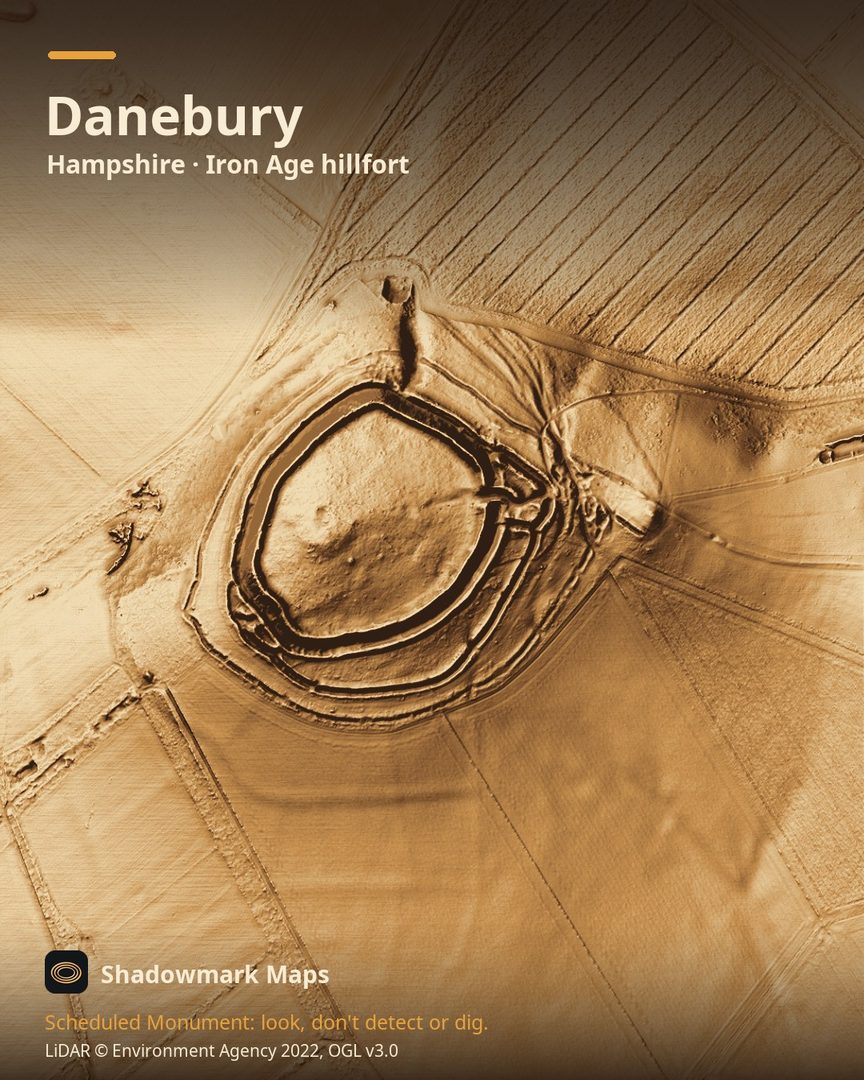
What you can see
- At Danebury you can still see the ring of ramparts and the gateway, and the earthworks around the entrance give a feel for how effective the defences were. (Hampshire County Council)
- Hampshire County Council says evidence suggests the fort was built about 2,500 years ago and occupied for nearly 500 years. (Hampshire County Council)
- Inside, the ground rises to a high spot in the centre, and subtle dips mark where grain stores once stood. (Hampshire County Council)
Visiting
Danebury is a Hampshire County Council countryside site and Local Nature Reserve; the council's Danebury page has the parking and walking details. (Hampshire County Council)
Official record: Historic England list entry 1001949: Danebury Hill camp.
Look, don't detect or dig
Danebury is a Scheduled Monument, protected by law because it's of national importance. In England it's a criminal offence to use a metal detector on a Scheduled Monument without Historic England's written consent, and to remove any object of archaeological or historical interest found with one. Damaging a scheduled monument is an offence too, and works on one, including digging, need Scheduled Monument Consent first. More on Scheduled Monuments and the rules.
Keep to paths and open access land, and follow the Countryside Code.
Get an email when it launches
Shadowmark Maps is coming to the App Store and Google Play. Leave your email and we'll tell you when it's out, with the links to download it.
More sites in LiDAR
Old Sarum · Stonehenge · Oakley Down · West Kennet Long Barrow · all sites