Shadowmark Maps › LiDAR sites › Grimspound
Grimspound in LiDAR
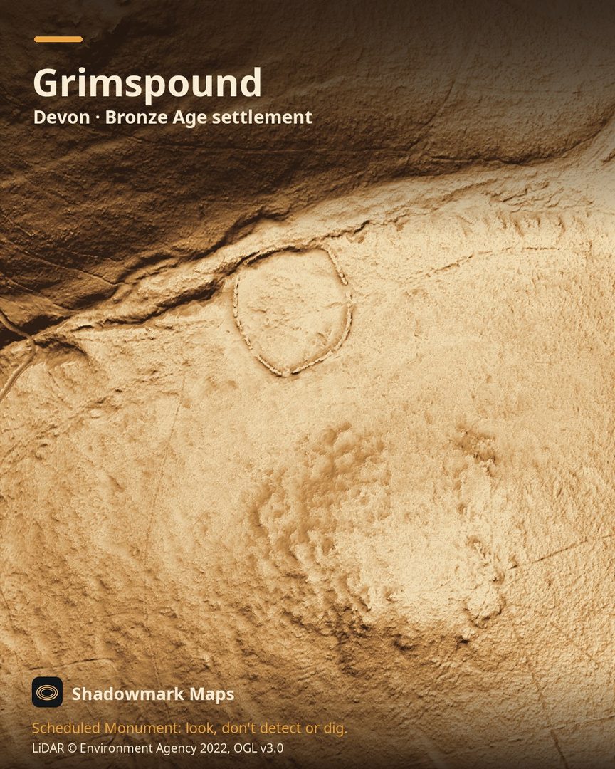
Grimspound is a Bronze Age settlement in Devon. Here it is in the Environment Agency's 1 m LiDAR, shaded so the shape of the ground stands out. Look for an oval walled enclosure of about 1.45ha in the saddle between two tors, with small round hut circles inside and a gap in its south-east side.
What you can see
- A stone and earth wall 2.5m to 3.5m wide encloses an oval area of 1.45ha containing at least 24 stone hut circles. (Historic England)
- The original entrance is a 2m-wide gap in the south-east side of the wall, flanked by walls up to 2m high. (Historic England)
- Just south-east of the enclosure, at least nine more hut circles sit among field walls and cleared ground. (Historic England)
- English Heritage dates Grimspound to the late Bronze Age, about 1450 to 700 BC. (English Heritage)
Visiting
English Heritage says entry is free and it is open any reasonable time during daylight hours, with limited roadside parking. (English Heritage)
Look, don't detect or dig
Grimspound is a Scheduled Monument, protected by law because it's of national importance. In England it's a criminal offence to use a metal detector on a Scheduled Monument without Historic England's written consent, and to remove any object of archaeological or historical interest found with one. Damaging a scheduled monument is an offence too, and works on one, including digging, need Scheduled Monument Consent first. More on Scheduled Monuments and the rules.
Keep to paths and open access land, and follow the Countryside Code.
Get an email when it launches
Shadowmark Maps is coming to the App Store and Google Play. Leave your email and we'll tell you when it's out, with the links to download it.
More sites in LiDAR
Hound Tor · Eggardon Hill · Ham Hill · Maiden Castle · all sites