Shadowmark Maps › LiDAR sites › Eggardon Hill
Eggardon Hill in LiDAR
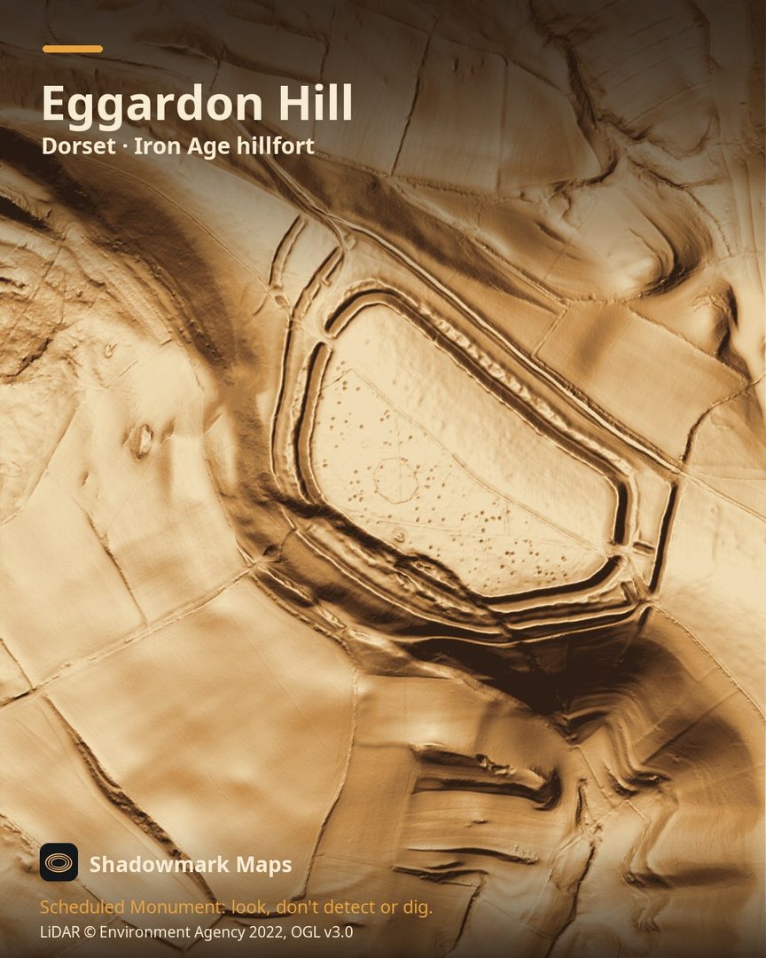
Eggardon Hill is an Iron Age hillfort in Dorset. Here it is in the Environment Agency's 1 m LiDAR, shaded so the shape of the ground stands out. Look for three ramparts with ditches between, complex staggered entrances on the north-west and east, an octagonal bank inside, and the interior pitted with small round hollows.
What you can see
- Eggardon is a hillfort of about 21 hectares in all, defined by three ramparts with two ditches between, plus extra banks at the staggered entrances and an outwork on the south-west. (Historic England)
- The interior is covered in circular hollows 3 to 5 metres across, the visible remains of buildings. (Historic England)
- An eight-sided banked enclosure inside the fort marks the edge of a coppice planted as a landmark for ships at sea. (Historic England)
- Two bowl barrows lie inside the hillfort; the larger is a round mound up to 14 metres across and 1.5 metres high. (Historic England)
Visiting
National Trust countryside open dawn to dusk; the Trust owns the southern half of the fort and the northern half is privately owned; there is free lay-by parking at the foot of the hill (not National Trust). (National Trust)
Official record: Historic England list entry 1002684: Large multivallate hillfort containing two bowl barrows 855m north east of North Eggardon Farm.
Look, don't detect or dig
Eggardon Hill is a Scheduled Monument, protected by law because it's of national importance. In England it's a criminal offence to use a metal detector on a Scheduled Monument without Historic England's written consent, and to remove any object of archaeological or historical interest found with one. Damaging a scheduled monument is an offence too, and works on one, including digging, need Scheduled Monument Consent first. More on Scheduled Monuments and the rules.
Keep to paths and open access land, and follow the Countryside Code.
Get an email when it launches
Shadowmark Maps is coming to the App Store and Google Play. Leave your email and we'll tell you when it's out, with the links to download it.
More sites in LiDAR
Maiden Castle · Ham Hill · Hod Hill · Hambledon Hill · all sites