Shadowmark Maps launches free LiDAR app on iPhone that warns metal detectorists off Scheduled Monuments
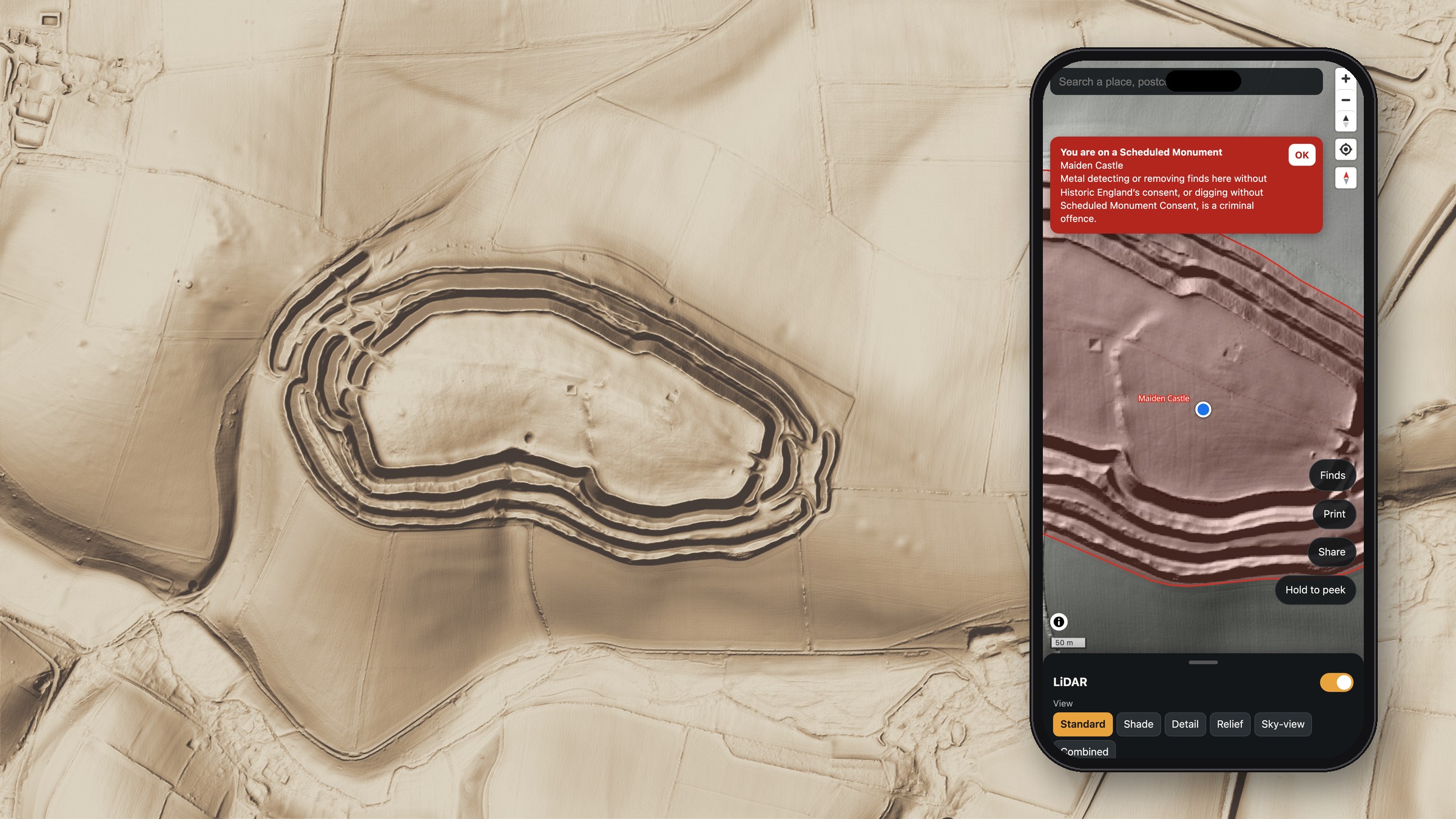
London, 7 November 2026. Shadowmark Maps, a free LiDAR map app from London company Shadowmark Ltd, launched on the App Store for iPhone on 6 November. It warns users when their phone's GPS puts them on or within 50 m of a Scheduled Monument in England, where metal detecting without Historic England's written consent is a criminal offence. The warning appears even when the monument layer is hidden. The app is already on Google Play for Android, and an iPad version is in development.
England has about 20,000 Scheduled Monuments, sites of national importance protected under the Ancient Monuments and Archaeological Areas Act 1979. Shadowmark Maps marks them in red and opens with the rules: get the landowner's permission, never detect or dig on a Scheduled Monument, report potential Treasure, and follow the Code of Practice for Responsible Metal Detecting.
"LiDAR makes these places easy to find, so the app tells you when you're on or near one," said a spokesperson for Shadowmark Maps. "Look as much as you like, but don't detect or dig there."
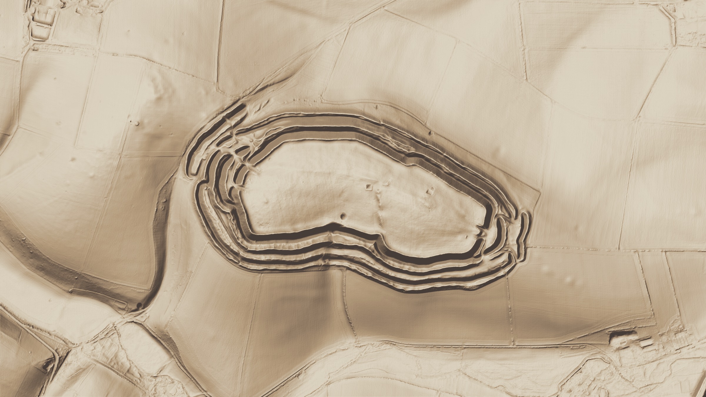
LiDAR measures the height of the ground with laser pulses sent from an aircraft. The app shades the Environment Agency's 1 m LiDAR terrain data, which covers about 99% of England from surveys flown between 2000 and 2022. Banks, ditches and old roads that are hard to make out on the ground stand out on screen: hillforts such as Maiden Castle in Dorset, Roman roads, deserted medieval villages and old field systems.
Free features include the national LiDAR shading, GPS position, place and grid-reference search that works without a signal, one offline area of up to 25 square kilometres, and a private finds log. The free shading also covers the United States, Canada, France and several other European countries. The app needs no account and shows no adverts. Advertising measurement is optional and stays off unless an adult turns it on. Location and finds stay on the user's phone.
Shadowmark Pro adds five sharper relief views, 3D terrain, unlimited offline areas and print export for England and the lower 48 US states. The relief views cover England, the lower 48 US states, the Netherlands and the surveyed parts of New Zealand (the Netherlands and New Zealand in the phone and tablet apps from version 1.2.3 on iPhone and iPad and 1.2.4 on Android); the US views use elevation data from the US Geological Survey's 3D Elevation Program (3DEP), the Dutch views the national AHN terrain model and the New Zealand views LINZ's 1 m LiDAR elevation model. The app gives no protected-site warnings outside England. Pro costs £5.99 a month or £39.99 a year with a 7-day free trial, or £119.99 once. App Store and Google Play prices apply in other currencies.
Journalists can request free review access to Shadowmark Pro and high-resolution images from press@shadowmarkmaps.com.
Notes to editors
- App Store: https://apps.apple.com/app/id6830289922
- Google Play: https://play.google.com/store/apps/details?id=com.shadowmarkmaps.app
- Press page and images: https://shadowmarkmaps.com/press.html
- Shadowmark Ltd is a London software company registered in England and Wales, company number 17533305. Shadowmark Maps is independent of any government body or data provider.
- LiDAR: © Environment Agency copyright and/or database right 2022, Open Government Licence v3.0. Scheduled Monuments: © Historic England 2026. Monument outlines are a guide, not a legal boundary, and cover England only.
Images
Free to use with the release. Click an image to download the full-size JPG (2400 px wide).
Press contact: press@shadowmarkmaps.com